 Site Map |
|
 | The latest walks fully explored and route assessed by members of the Roy's Roams Team |
To view the full catalogue of Roy Approved Walks (RAW) click the following link --->Up to date version July 2017, listing 352 walks <--- |
| Sunday TBA 11:00am | Wild Boar Fell. Moderate to strenuous Yorkshire Dales fell walk to Swarth Fell, Wild Boar Fell and Hell Gill Force. The atmospheric back drop to the summit of the Settle Carlisle Railway. 7 miles, pub call afterwards. |
Meet on roadside at Cotegill Bridge near Ais Gill on the B6259 Garsdale Head to Kirkby Stephen road. NGR SD773969, (N54°22'03” W2°20'58”), SatNav post code CA17 4JY. |
| Sunday TBA 11:00am | Reach for the Fells. Lake District moderate to strenuous fell walk over Loughrigg Fell including Ivy Crag, Lily Tarn and Todd Crag. 7 miles, pub call afterwards. |
Meet on Rydal Road P&D car park in Ambleside. NGR NY375046, (N54°26'02” W2°57'51”), SatNav post code LA22 9AN. |
| Sunday TBA 11:00am | Strickland Roger. South Lakes moderate walk from Staveley via Potter Tarn, Gurnal Dubs, Braben House and Cowan Head. 8 miles, pub call afterwards. |
Meet in Wilf's Yard on right shortly after Church (Toilets further on on left). Turn right off A591 Kendal/Windermere road over level crossing into Staveley. NGR SD472982, (N54°22'38” W2°48'55”), SatNav post code LA8 9LR. |
| Sunday TBA 11:00am | Nursery of the Ribble. Moderate undulating hill and dale walk to God’s Bridge, Selside and Colt Park. Not exactly the birth place of the River Ribble but certainly where it spends its character forming early days amongst the Settle to Carlisle railway fells. 7 miles variable according to weather, pub call afterwards. |
Meet on large space on the right of the B6479 just after Gauber House. This is the Settle to Ribblehead road 2 miles after Selside. NGR SD771788, (N54°12'17” W2°21'04”), SatNav post code LA6 3JF. |
| Sunday TBA 11:00am | Lyth Valley Link. Moderate undulating hill and quiet lanes walk to Hubberstsy Head, Fell Edge, Township Allotment and Crosthwaite. Intimate views of the Lyth Valley. 7 miles, pub call afterwards (The Miners Inn). |
Meet on Brackenrigg layby. M6 Junction 36 onto A590 to Gilpin Bridge. Turn right up the Lyth Valley on A5074 passing The Lyth Valley Hotel. Road makes a sharp left at Crosthwaite and then sharp right past Damson Dene. Lay by then a mile on left. NGR SD422926, (N54°19'33” W2°53'21”), SatNav post code LA8 8JD. |
| Sunday TBA 11:00am | Ingleborough the Smart Way. Strenuous Yorkshire Dales fell walk to Crina Bottom, Ingleborough Summit, Little Ingleborough and Cold Cotes. 8.5 miles, pub call afterwards. | Meet on Ingleton (P&D) village car park by information centre. NGR SD694730 (N54°09'07” W2°28'09”), SatNav post code LA6 3BP. |
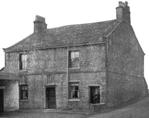
| Sunday TBA 11:00am | Changing Scenery. Moderate undulating urban and rural trails walk to Peel Park, Spout House Woodland, Altham, Enfield and Whinney Hill. See where the original Nori bricks came from. 7 miles, pub call afterwards (The Whitakers Arms). |
Meet by the Whitakers Arms in Burnley Road, Accrington (facing cemetery). M65 Junction 8 onto A56 dual carriageway towards Bury but only for Ľ mile. Then take slip road to Huncoat and Accrington turning right at roundabout. Under flyover, across next roundabout and past the Griffin’s Head pub on the right. The Whitakers is ľ mile on the left. NGR SD769295 (N53°45'44” W2°21'02”), SatNav post code BB5 6HG. |
 |
 |
 |
|
 |
 |
 |
 |
 |
 | |